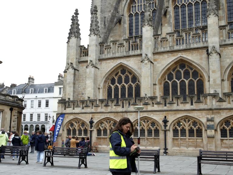
51.380353, -2.369224
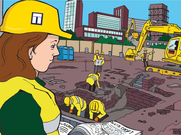
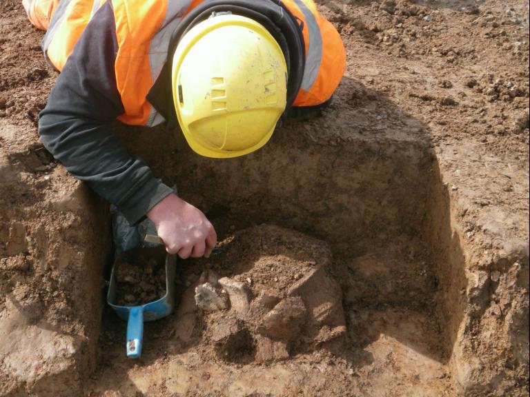
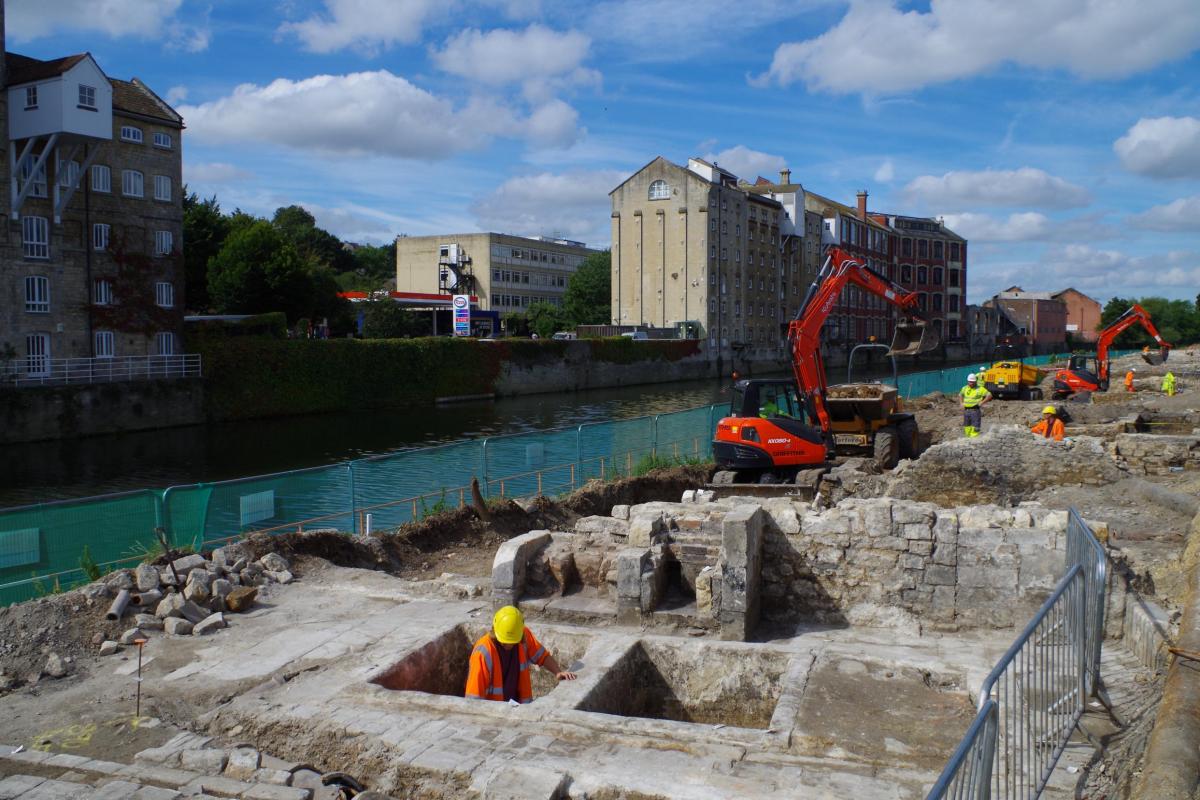
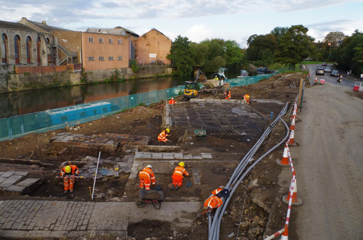
In 2016-17, Wessex Archaeology carried out a major excavation ahead of a flood mitigation and development-enabling works at Bath Quays Waterside, the results of which have been published in our latest occasional paper – Bath Quays Waterside: The archaeology of industry, commerce and the lives of the poor in Bath’s lost quayside district. The work was commissioned by Alun Griffiths Ltd, on behalf of Bath and North East Somerset Council, and comprised desk-based assessment, evaluation, excavation and publication.
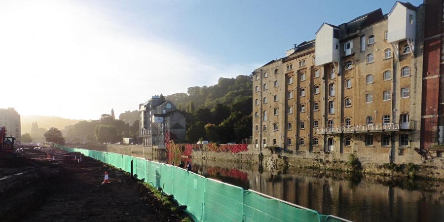
The Bath Quays Waterside development entailed diverting a road and reducing the riverside ground level to create a pedestrian and cycle-friendly park with space for outdoor activities, events and recreation. The new park provides a welcome oasis close to Bath’s bustling city centre, but its present appearance belies a rather different past: this was once the heart of the Avon Street district – a notorious area, constructed in the 18th century and demolished in the 1930s, which was once synonymous with crime, disease and poverty. Our excavations uncovered extensive well-preserved remains of the buildings that once flanked the quayside and revealed evidence of how the area developed from the late medieval period onwards.
Medieval and early post-medieval activity
Bath Quays Waterside is situated 100 m to the south of Bath’s Roman and medieval city walls, in a low-lying and historically flood-prone area. Previous excavations at Southgate produced very little evidence for Roman activity to the south of the town walls, and there is similarly little evidence for activity at Bath Quays during this period.
During the medieval period, an extra-mural suburb developed between the city’s south gate and a bridge over the Avon that provided access to the town from the south. Early maps, dating from c. 1600 onwards, show that the bridge was protected by a gatehouse. The south and east sides of the suburb were defined by a loop in the river, whilst the western approach was demarcated by an artificial watercourse flanked by battlemented wall. This watercourse – sometimes known as the Fosse Dyke – served as an outfall for the city’s western geothermal springs and marked the extents of city jurisdiction prior to 1590. It is uncertain when the ditch was first dug, but it certainly existed by the 13th century, when it formed the boundary between the lands of Bath Abbey and a meadow they granted to the Hospital of St John.
Our excavations uncovered a section of this ditch, which was 6 m wide and over 2 m deep. The east side of the ditch was defined by the foundations of a substantial clay-bonded wall, which was probably constructed between the 13th and 16th centuries.
During the 17th and early 18th century, small scale quarrying for gravel, and possibly clay or sand, was undertaken and a small stone footbridge was constructed over the Fosse Dyke, but otherwise the riverside meadows (known as Kingsmead and Ambury) remained largely undeveloped. The bridge, which was built sometime between 1685 and 1735, was subsequently incorporated into a mid-18th-century culvert which ensured its survival beneath later developments. The bridge has been preserved in situ under a low hillock in the new park
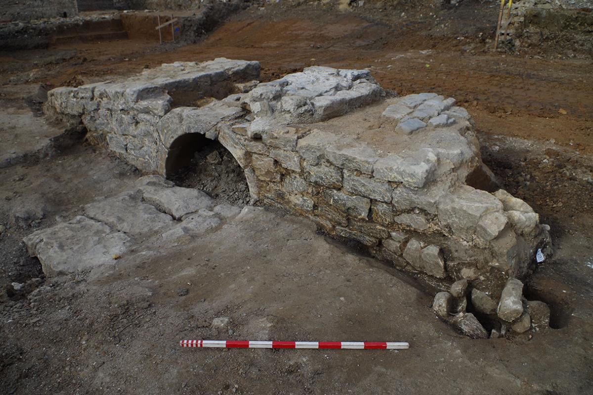
c. 1685–1735 footbridge
18th-century development
During the 18th century, Bath was transformed from a provincial city into a fashionable spa. It was during this period that most of the neo-Classical architecture that contributed to Bath’s status as a World Heritage Site was constructed. Whilst the Bath Stone used in the construction of these buildings could be sourced from nearby quarries, other materials, such as sandstone for paving, lead, timber, slate, bricks and tiles, all had to be imported from outside the area. Unfortunately, the construction of mills on the Avon during the medieval period prevented its use as a navigable watercourse. As a result, the only method of transporting goods into or out of the city were steep and poorly maintained roads. This was clearly not an ideal situation, which was eventually remedied by making the River Avon navigable between Bath and the nearby port of Bristol. This waterway, known as the Avon Navigation, opened to traffic in 1727, though its eastern terminus – Broad Quay – wasn’t built until 1729.
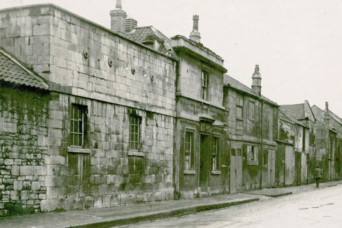
Initially, development of the riverside meadows was focused around the quayside and a new road, Avon Street, which was laid out in the late 1720s. The houses along Avon Street were designed as lodgings for wealthy visitors to the spa, whereas the waterfront buildings were predominantly warehouses and commercial premises. At the southern end of Avon Street, there was a small quayside with a range of commercial buildings and warehouses ranged around it. The proximity of a busy quayside and competition from more fashionable developments in the north of the city soon led to a decline in the area’s status, and by the late 18th century the street had acquired a less than salubrious reputation. By this date, the whole area around Avon Street and the quay had been infilled with streets of densely packed houses and industrial premises. In addition to the cheap lodging houses, brothels and tenement blocks that characterised the area during this period, our excavations have uncovered well-preserved remains of a fellmongers’ and parchments works, and the Duke of York beer house – one of the many taverns that once surrounded the quayside.
The remaining parts of Ambury and Kingsmead were developed between 1760 and 1795. The new buildings comprised a mixture of artisan housing and commercial premises.
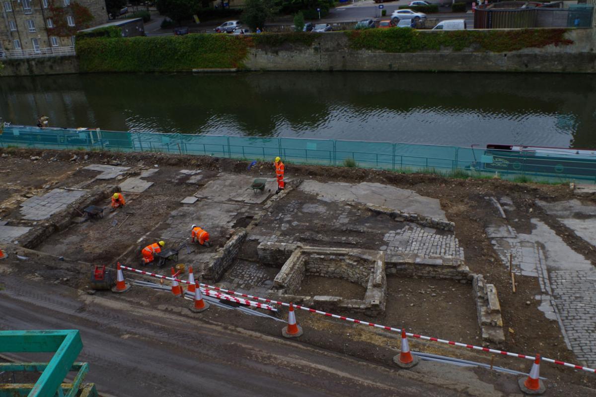
18th-century fellmongers’ and parchment works (left), 18th-century quayside buildings (right)
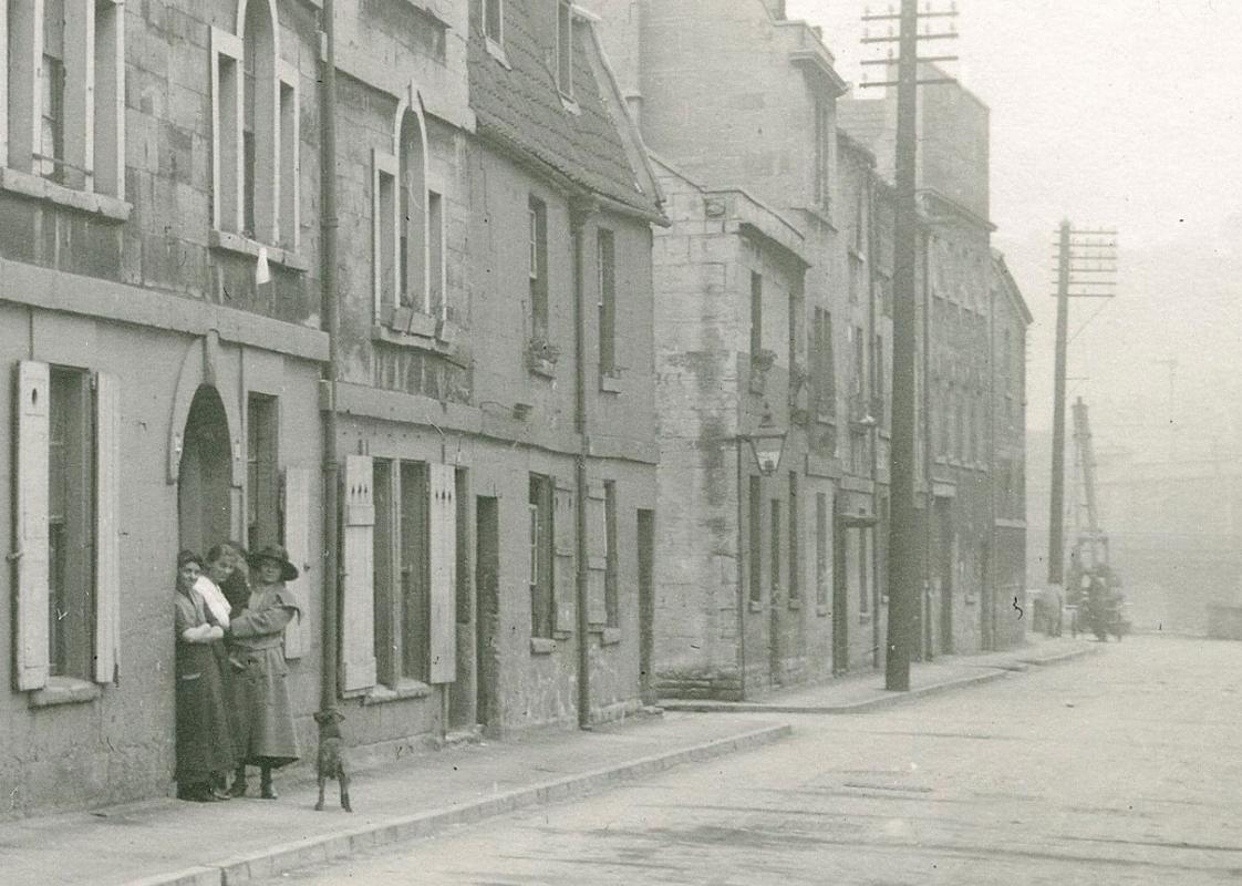
c. 1930 photograph of 18th-century tenements and warehouses along the quayside © B&NES Council
19th-century industrialisation
The opening of the Kennet and Avon Canal in 1801 and the Great Western Railway in 1841 provided alternate methods of transporting goods, which inevitably led to decline in trade along the Avon Navigation, and by extension the quay. The declining importance of the quay was, however, counterbalanced by an expansion of the industrial premises which increasingly dominated the area. These new firms included a pottery, clay tobacco pipe manufacturers, brewers, dyers, and several brass and iron foundries that subsequently became innovative engineering firms. The latter included companies that manufactured steam engines, aerated water bottling equipment, gas fittings and most significantly Stothert and Pitt, who specialised in the production of large dockside cranes that were exported internationally.
Industrialisation of the Avon Street district had mixed impacts on the local population. Whilst smoke and effluvia from factories would have had a detrimental impact on local air and water quality, the increasing availability of skilled and semi-skilled industrial work would have provided job opportunities for many.
Public health and the Milk Street Baths
The expansion of industry was accompanied by the further infilling of tenement back plots with courts of insanitary and overcrowded housing, and by the mid-19th century the Avon Street district was home to 10,000 of the city’s poorest residents. Our research has shown that although most of their houses were reasonably well built, maintenance was neglected and access to water and sanitary facilities was poor: wells and lavatories were typically shared between multiple households and the two were frequently sited far too close together. This proved to be a perfect breeding ground for infectious disease: epidemics of smallpox and influenza were frequent and in 1832 a previously unknown disease – cholera – visited its full fury on the district.
Prior to the 1880s, contagious diseases were widely considered to be spread via miasma or ‘bad air’ emanating from rotting organic matter, and although the means of transmission was misunderstood, the association between ill health and dirty living conditions was recognised. Consequently, many of the public health measures instigated in the 1840s were designed to combat the perceived threat from bad smells and dirt. One of the ways in which the authorities sought to deal with this problem was by the provision of public washing facilities and laundries, particularly in poorer urban areas. One of these institutions, the Milk Street Baths, was situated a short distance to the west of the 18th-century quayside.
The Milk Street Baths, which opened in 1847 and was substantially expanded in 1853, is the first well-preserved example of an early Victorian public washhouse to have been archaeologically excavated. Our excavations have shown that the baths were fitted with a small steam engine that pumped filtered river water into a large rooftop reservoir, where it was stored until it was needed. To heat the water, there was a twin bank of Lancashire boilers that provided hot water and steam for bathing and washing clothes. Apart from a few minor alterations in the later 19th century, the washhouse remained largely unaltered until it was demolished in 1930.
The Milk Street Baths (left) c. 1930 photograph of the Milk Street Baths © B&NES Council (right)
The end of the Avon Street district
By the early 20th century, concern over poor housing conditions, lead to proposals to demolish the Avon Street district and redevelop it with new lower density housing and public buildings. Most of the area was demolished in the 1930s, but the planned redevelopment was never fully implemented due to the outbreak of the Second World War. As a result, the cleared plots remained derelict, and the area was eventually tarmacked over for use as a car and coach park. The development of Bath Quays will in effect complete the long-stalled redevelopment of former Avon Street district and help re-establish a link between the city and the river which was instrumental to its development in the 18th and 19th centuries.
To purchase the publication, follow this link.